
When I started in Primary (working with 3-6 year olds) we sang the continent song and traveled around the globe as the year progressed focusing on a different continent every few months. Even for small people it brings the world closer. When I taught Lower Elementary we studied countries and worked on pin maps and puzzle maps. Fast forward to Upper Elementary and the geography fun continues!
When the school year began I stepped into a brand new classroom with a group of young veteran Montessorians. I knew very little about the 20 learners in front of me and as most kids claim, they didn't know any Montessori lessons! :) It wasn't long into the school year that I was losing my mind and they frankly were bored to tears waiting for me to figure it all out and find things for them "to do". And then someone asked if they could make a map...and the angles sing! Of course, let's make maps!
So, armed with butcher paper and colored pencils and a little bit of direction (that you can grab for free from my TPT).
 |
| Click here to access resource in my TPT store! |
They traced maps, did research, labeled maps and prepared to present to the class. When they finished creating they proudly displayed them in the hallway.


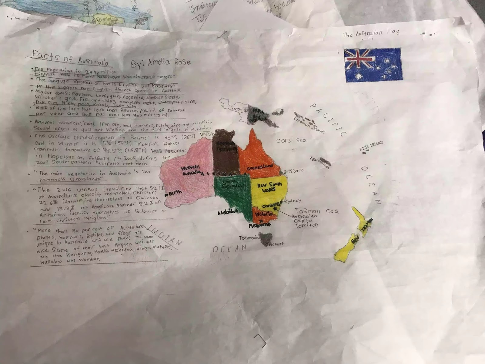
The pictures don't do the work justice but the maps ended up giving me a great deal of insight into the abilities and needs of my kiddos. It gave them meaningful purpose filled work and it got our school year off to a great start!
No comments:
Post a Comment